FINAL UPDATE: Tuesday, August 6 @ 9:30 a.m.
As this is written, we have 49 members without power from TS Debby. Tropical storm watches and warnings for overland areas have been discontinued. Backend bands are likely to bring brief heavy downpours and possible thunderstorms, but nothing unlike our usual summer thunderstorms.
We will resume normal operations, and all offices open at 8 a.m., Wednesday, August 7
Cancellations and disconnects will resume on Friday, August 9. If you need to make a payment, they can be made at the night drops at each office or cash payments can be made at Pay Where You Shop locations.
Monday, August 4 @ 8 p.m.
While the worst of the storm's impacts are expected overnight, the good news is rain amounts and wind intensity is diminished from our earlier update due to the fact the center of the storm has tracked further north. Outages from downed trees and limbs continue to be expected, and our OREMC and mutual aid crews will work late into the evening as long as it is safe to do so. Once conditions worsen they will come in for rest and roll out again at 6 a.m. tomorrow.
Monday, August 4 @ 5 p..m.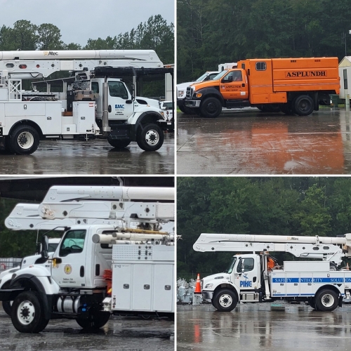
TS Debby made landfall this morning and has slowed to a crawl as the center of the storm is expected to cross over Waycross and continue to move northeast. Rain estimates remain steady at 12 – 15 inches, but because of the change of speed and projected track, higher winds are now anticipated overnight with gusts up to 90 mph. Tornado watches and warnings are expected later this evening.
OREMC crews have been working throughout the day to respond to outages caused by the storm We have 145 mutual aid personnel staged or expected tomorrow morning to assist us with storm response and outage response. These include crews from Asplundh, Pike, Terravault, Osmose, TRC and our sister co-ops North Georgia EMC and Coweta-Fayette EMC.
We understand everyone wants power restored as quickly as possible, but safety is our first priority. Make sure the phone you report your outage from is tied to your account location. This will more accurately pinpoint your outage for more timely response. If you are using a generator, please follow all safety procedures and use the Outage Map to see if power has been restored in your area.
Monday, August 5 @ 10 a.m.
All OREMC personnel are focused on storm response, recovery and power restoration. As such, all OREMC offices are closed until Thursday, August 8. However, the Nahunta office drive thru window will remain. Additionally, collections and disconnects have been suspended until Thursday, August 8.
Sunday, August 4 @ 5 p.m.
TS Debby is still making her way toward Florida’s west coast and now expected to make landfall at 8 a.m. Monday morning. As a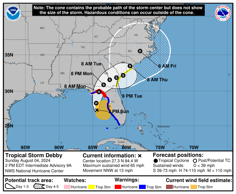 result, major impacts across the OREMC service area are anticipated for Monday afternoon into Tuesday. NOAA and the National Hurricane Center are predicting “historic, heavy rainfall” and a “once in a 500 -1,000 year” flooding event for some areas. Predictions currently stand at 6 – 20 inches of rain across the OREMC service area.
Because of the flooding threat, it is important to note that should outages occur, those in low lying areas should expect delays in getting their power back on because of roads being closed or otherwise inaccessible due to high water. OREMC is preparing its outage response and has mutual aid crews arriving tomorrow to stage and be ready to roll out once conditions make it safe to do so.
If you haven’t already, NOW is the time to make sure you have enough food, water, medications and other essentials for every member of your family including pets. Recommendations say to prepare for 3 – 7 days. Visit our Storm Preparedness page for more information.
